Colorado counties county maps

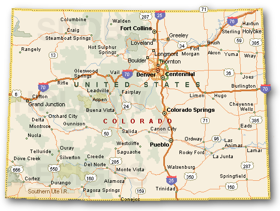
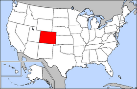
Colorado. A state of the west-central United States. It was admitted as the 38th state in 1876. First explored by the Spanish in the 16th and 17th centuries, the region was added to the United States through the Louisiana Purchase (1803) and a cession by Mexico (1848). The Colorado Territory was organized in 1861. Denver is the capital and the largest city. Population: 5,029,196 (July 2014)

State Flower: Rocky Mountain Columbine - State Motto: Nothing Without Providence - State Nickname: Centennial State - State Bird: Lark Bunting

Weather Search countymapscolorado.com
Custom Search
무료 웹툰 사이트 뉴토끼 바로가기 링크 Click here for complete list of counties, cities & towns Advertise Here
Counties:
* Adams
* Alamosa
* Arapahoe
* Archuleta
* Baca
* Bent
* Boulder
* Broomfield
* Chaffee
* Cheyenne
* Clear Creek
* Conejos
* Costilla
* Crowley
* Custer
* Delta
* Denver
* Dolores
* Douglas
* Eagle
* El Paso
* Elbert
* Fremont
* Garfield
* Gilpin
* Grand
* Gunnison
* Hinsdale
* Huerfano
* Jackson
* Jefferson
* Kiowa
* Kit Carson
* La Plata
* Lake
* Larimer
* Las Animas
* Lincoln

Full color County maps, list of cities, towns, State of Colorado

vail colorado springs

denver colorado

Counties:
* Logan
* Mesa
* Mineral
* Moffat
* Montezuma
* Montrose
* Morgan
* Otero
* Ouray
* Park
* Phillips
* Pitkin
* Prowers
* Pueblo
* Rio Blanco
* Rio Grande
* Routt
* Saguache
* San Juan
* San Miguel
* Sedgwick
* Summit
* Teller
* Washington
* Weld
* Yuma

Advertise with Us

Full Color County Maps - countymapsusa.com

Design & Hosting by: 우드슬랩 곤지암리조트렌탈샵 글자수세기
©2006-2017